Airport Identifier:
25UElevation:
6708Latitude:
45.4278611Longitude:
-116.6938889Located on the rim of Hells Canyon on the Oregon side, about 5,000 feet above the Snake River. No camping amenities at the airstrip.
Airstrip Features:
Windsock
Classification:
Primitive Classification
Airstrips have basic navigational aids such as windsocks and runway markers and some limited user facilities. Typically located in remote settings but may be accessed by low-standard road.
Primary Runway:
17/35Length:
3300Type:
DirtAirstrip Manager:Brandon Culley, USFS |
|---|
District:#2 Lewis and Clark |
|---|
District Director:Bill Ables |
Observation Date: October 10, 2024
Cows on the runway before departure but otherwise, runway is in decent shape. More uphill than I was expecting when landing South.
Observation Date: June 11, 2023
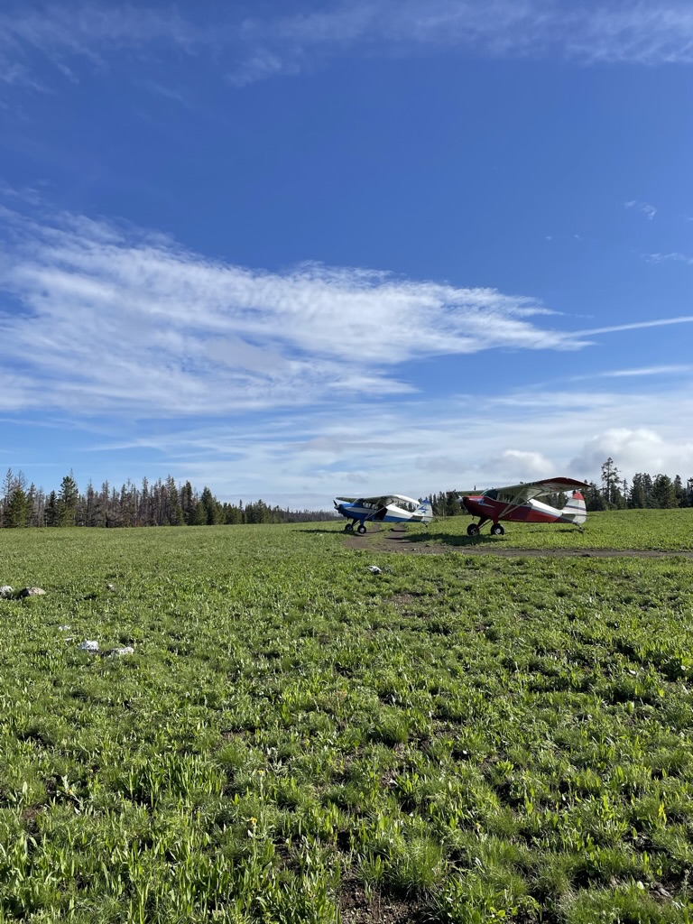
Stopped in for a quick visit to cook some breakfast and enjoy the early morning air. The north end of the strip is still very wet and muddy. Landing short on the south end was just fine and pretty smooth. The views and wildflowers were great!
Observation Date: July 1, 2022
The runway is a mixed bag. Landing 17, the first 350’ is soft/mud; then the next section upto the helo pads (seen brown on the approach photo) is rocky with 2-6” rocks; next up is deep ruts and soft mud upto the windsock. The final (uphill) section is fine. Overall, the runway is a narrow single track, with unseen hazards lurking in the weeds either side. Land long and stay on track, it’s fine. Depart downhill on 35 and most will be airborne before the tricky stuff.
Observation Date: June 7, 2022
Overflew but did not land. Strip looked very wet in between bands of 6-12 in of snow. Maybe another couple weeks before it's landable?
Observation Date: June 7, 2022
From flying overhead, airstrip was covered in melting snow and standing water. We'll try it another day.