Airport Identifier:
C64Elevation:
3505Latitude:
46.6665842Longitude:
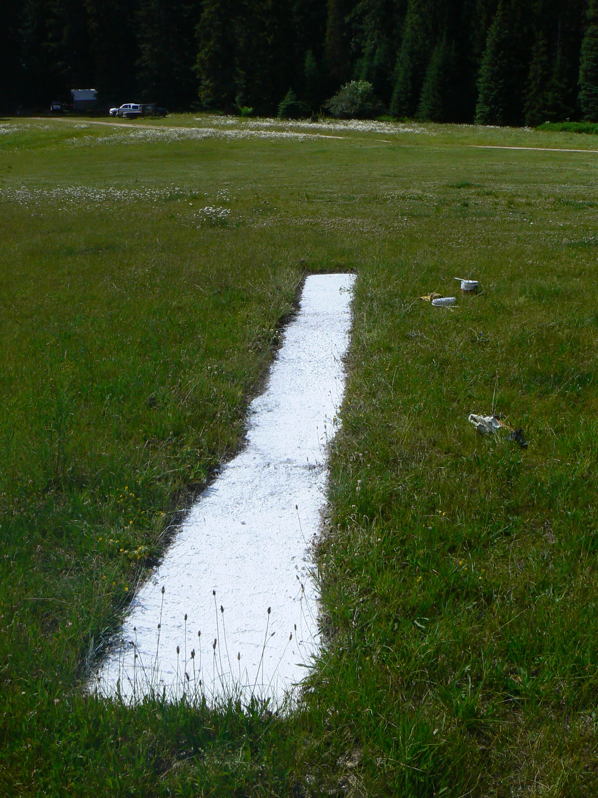
-115.0731811For many years, this airstrip was listed as "Restricted" on FAA charts, meaning planned landings could not be made without permission from the Forest Service. With encouragement from the Idaho Airstrip Network, that designation was removed in early 2011. The airstrip's turf surface is good by backcountry standards, although not regularly maintained. There are no camping facilities at the airstrip, but wilderness camping and good fishing are available along Cayuse Creek.
Airstrip Features:
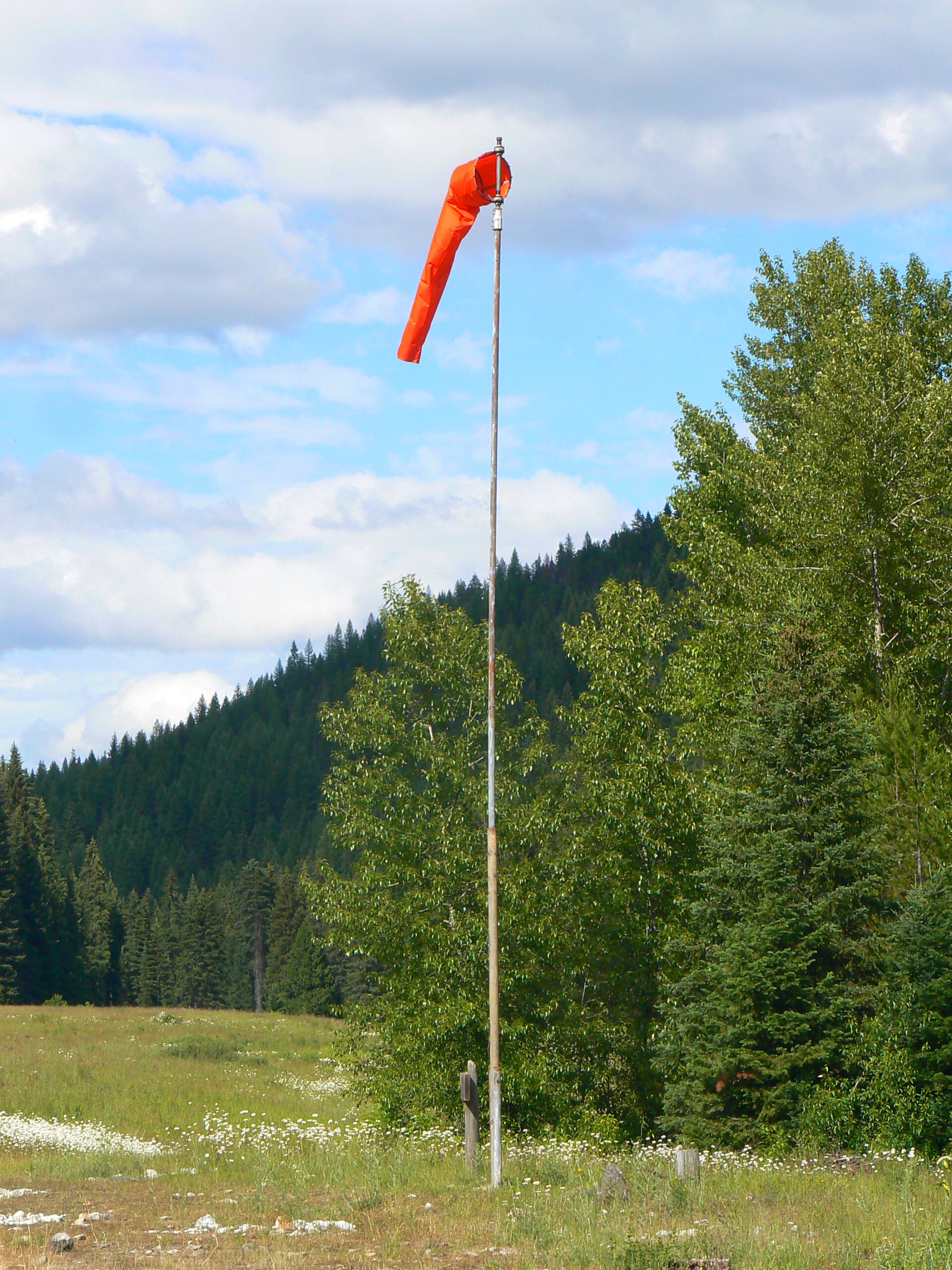
Windsock
Segmented Circle
Classification:
Wild Classification
Airstrips may have basic navigation aids such as windsock and runway markers and no user facilities. Typically located in the remotest settings away from roads and communities.
Primary Runway:
4/22Length:
1800Type:
TurfStuck 'N Stay Emergency Accommodations
IAA Member Hosts
Member Name
Tom Richardson
Airstrip Manager:Andrew Skowland |
|---|
|
208-476-4541
|
District:#1 North Idaho |
|---|
District Director:Don McIntosh |
Observation Date: June 27, 2025
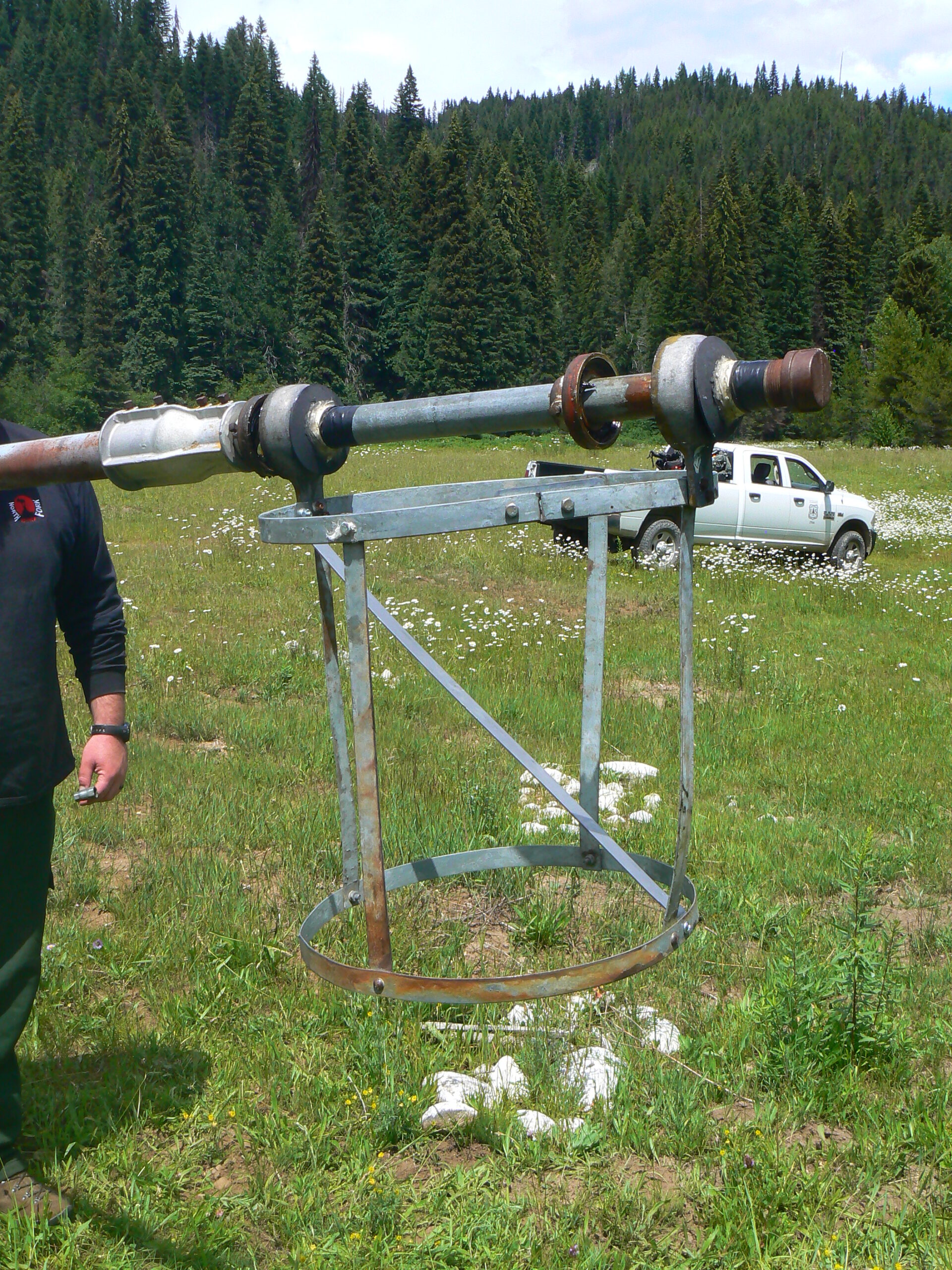
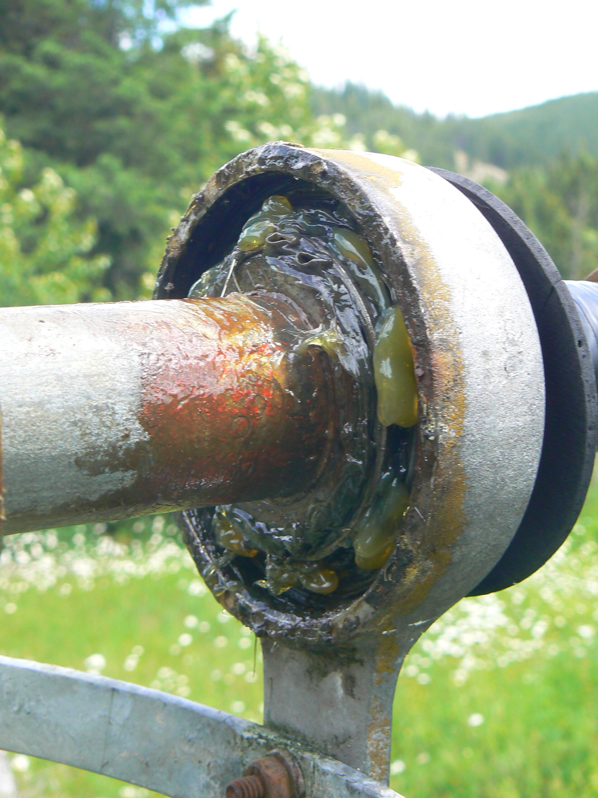
Coordinated with Forest Service for help to get some work done at Cayuse. Got the windsock down (with required 4x4 and cable), installed a diagonal brace on frame to prevent winter snow load from bending, lubed the bearings (it an old antique 70+ years frame with real roller bearings - don't make them like that anymore) and installed new 18 inch sock. Painted the runway threshold markers, cut two cottonwoods down that were blocking the windsock. Cut and piled a bunch of lodgepole and cottonwood saplings beginning to encroach on edge of airstrip NW side approach end. Ran out of paint and time for segmented circle but will get that painted in week or two. New sign on grave site adjacent to airstrip.
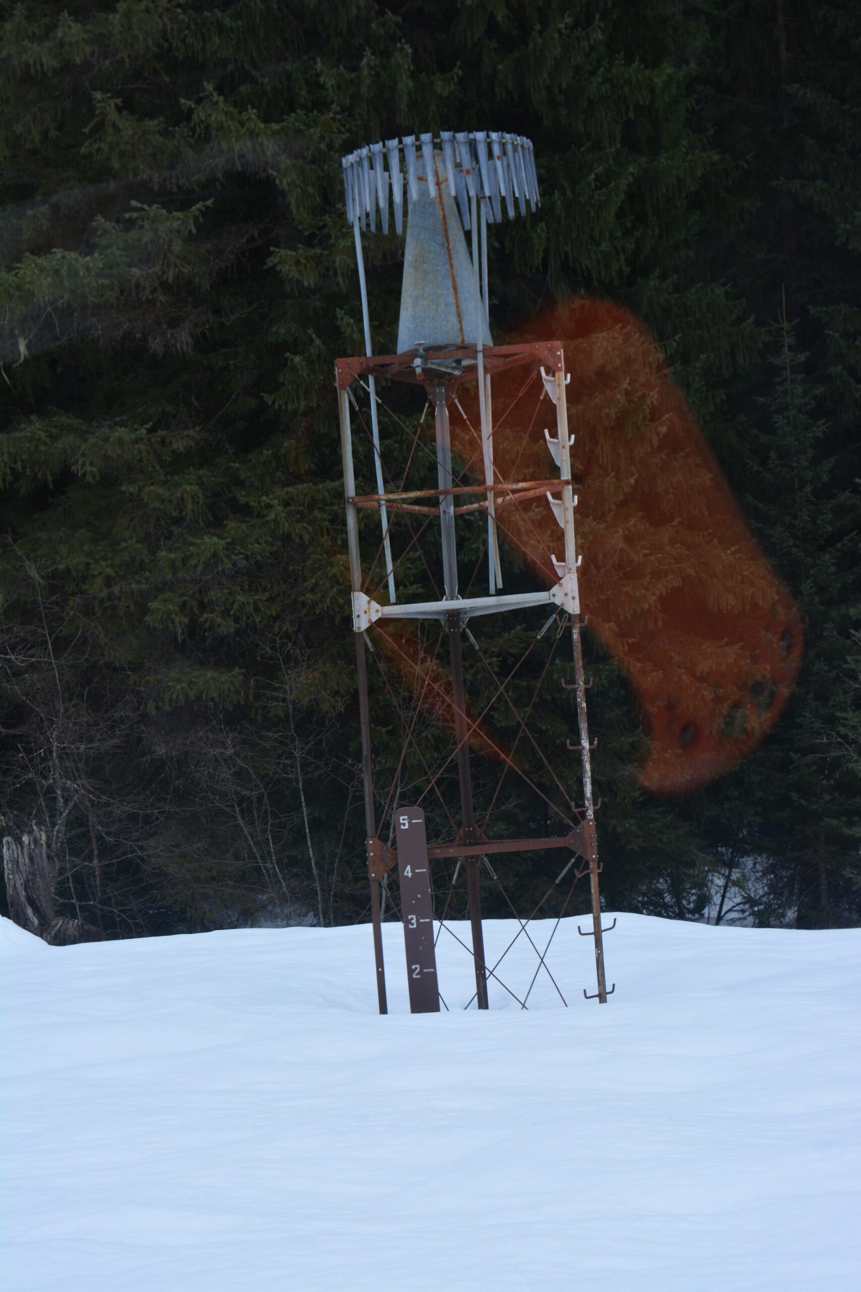
Observation Date: March 30, 2025
Landed briefly at Cayuse Airstrip on Sunday 3/30/2025 with the helicopter. Runway and surrounding flat still completely covered with snow. It looks to be about 14 inches deep on snow depth gauge and is heavy, wet and soft. Here is a link to a video of the airstrip that day: Cayuse Video 03/30/25